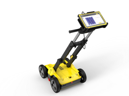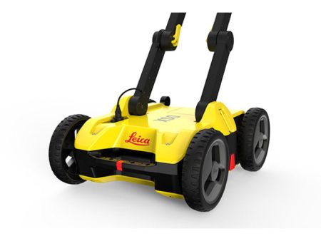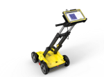
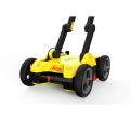
Leica Geosystems DSX GPR for Rent For Cheap
Description
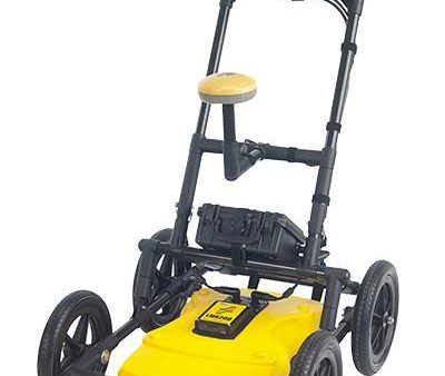
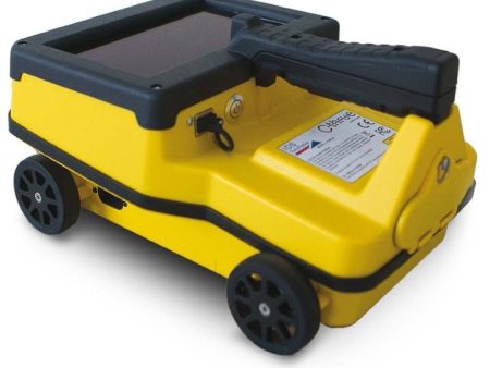
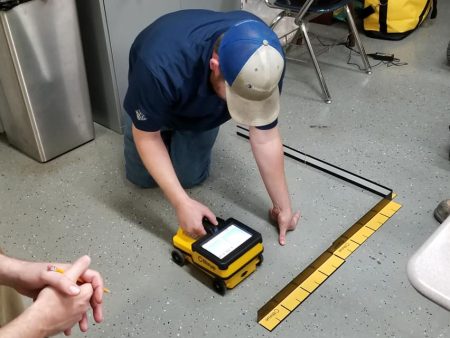
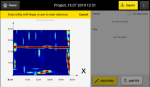
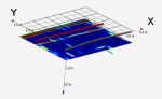
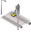
For underground utility repair and maintenance requirements, the Leica DSX utility detection solution provides an easy to use ground rover with intelligent software, allowing you to locate, visualize utilities, and generate a 3D utility map. Unlike any other ground penetrating radar (GPR) system, the DSX solution maximizes productivity with cutting-edge software that automates data output, guides you to the correct way to collect data, and creates a 3D utility map right in the field.
Reliable Detection Result
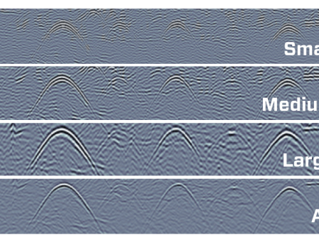
- Detect all types of underground utilities in high resolution to assure reliable avoidance zones
-
- Verify detected utilities and give you peace of mind
-
- Supports importing point-of-interest aspects as well as utility records to help you make better decisions
-
Ease of Use
- Ensure smooth and accurate underground utility detection without expert knowledge
-
- Complete utility detection and mapping in just a few steps through intuitive user interface
-
- Scan anywhere and at any time, even in narrow areas and under severe conditions
-
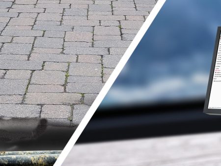
Uncovering utilities clearly and effortlessly
The solution consists of portable hardware and an all-in-one upgradeable DXplore software. The software is offered as permanent subscription and time-limited options, to match your project requirements and allow maximum flexibility.
Instant 2D 3D Utility Map
- Save time on site by mapping underground utilities in just minutes
-
- Export utilities in CAD or BIM-ready formats for further usage
-
- Create professional reports, customizable
-
Integrated Solution
- Offers a complete workflow from data acquisition to excavation
-
- Locate underground utilities with survey-grade accuracy
-
- Generate utility maps, compatible with all coordinate reference systems
-
DSX Utility Detection Radar
CT1000 Tablet
Central Frequency
600 MHz
Display
11.6
Detection Depth
Up to 2m 6.56ft
Processor
Intel® Core™ i3-7100U
Acquisition Speed
Up to 7km h or 4.3mph
Memory
RAM 4GB, 128GB SSD
Scan Interval
0.50m 18in
Operating System
Windows 10 Professional
Positioning
2 encoders on wheels; GNSS antenna integration (Surveyor kit only)
Positioning
GPS (GlobalSat)
Environmental
IP65
Environmental
Sunlight readable display (LCD + Touchscreen + Hard Tip stylus)
IP65 MIL-STD-810G
Weight
(without battery and tablet)
Weight
1.39Kg
Battery
Li-ion 14.8V 5800mAh
up to 8 hours operating time
Battery
Li-Ion 11.4V 2160mAh
Operating Temperature
–10°C to +40°C 14°F to 104°F
Communications
WiFi, Bluetooth v4.2, 4G LTE
(Model 880920)
RJ45 – connection to DSX
Warranty
2 years (extension CCPs available)
Warranty
2 years Global Warranty
(battery – 1 yr)
Additional Information
Title
Default Title
Related products
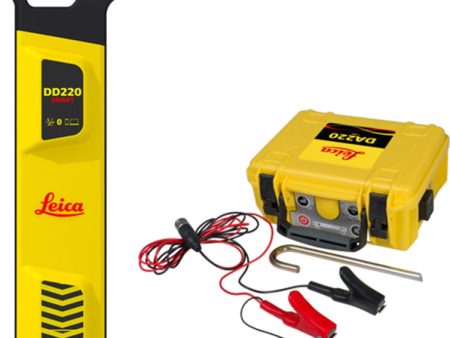
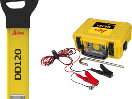
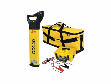
Leica DD200 Series Cable Avoidance Tool Sale
Original price was: $3,319.00.$995.70Current price is: $995.70.
Sensors & Software LMX GPR For Rent For Cheap
Original price was: $20,800.00.$6,240.00Current price is: $6,240.00.
Leica DD100 Series Cable Avoidance Tool Online Sale
Original price was: $2,419.00.$725.70Current price is: $725.70.
IDS Cthrue For Rent For Discount
Original price was: $13,600.00.$4,080.00Current price is: $4,080.00.
Leica Geosystems DSX Supply
Original price was: $25,000.00.$7,500.00Current price is: $7,500.00.

peakusflow.shop © 2025 All Rights Reserved
-
-
Select the fields to be shown. Others will be hidden. Drag and drop to rearrange the order.
- Image
- SKU
- Rating
- Price
- Stock
- Description
- Weight
- Dimensions
- Additional information
- Add to cart
- Detect all types of underground utilities in high resolution to assure reliable avoidance zones
- Verify detected utilities and give you peace of mind
- Supports importing point-of-interest aspects as well as utility records to help you make better decisions
-
- Ensure smooth and accurate underground utility detection without expert knowledge
- Complete utility detection and mapping in just a few steps through intuitive user interface
- Scan anywhere and at any time, even in narrow areas and under severe conditions
-
- Save time on site by mapping underground utilities in just minutes
- Export utilities in CAD or BIM-ready formats for further usage
- Create professional reports, customizable
-
- Offers a complete workflow from data acquisition to excavation
- Locate underground utilities with survey-grade accuracy
- Generate utility maps, compatible with all coordinate reference systems
-
- Image
- SKU
- Rating
- Price
- Stock
- Description
- Weight
- Dimensions
- Additional information
- Add to cart
DSX Utility Detection Radar CT1000 Tablet Central Frequency 600 MHz Display 11.6 Detection Depth Up to 2m 6.56ft Processor Intel® Core™ i3-7100U Acquisition Speed Up to 7km h or 4.3mph Memory RAM 4GB, 128GB SSD Scan Interval 0.50m 18in Operating System Windows 10 Professional Positioning 2 encoders on wheels; GNSS antenna integration (Surveyor kit only) Positioning GPS (GlobalSat) Environmental IP65 Environmental Sunlight readable display (LCD + Touchscreen + Hard Tip stylus)
IP65 MIL-STD-810GWeight (without battery and tablet) Weight 1.39Kg Battery Li-ion 14.8V 5800mAh
up to 8 hours operating timeBattery Li-Ion 11.4V 2160mAh Operating Temperature –10°C to +40°C 14°F to 104°F Communications WiFi, Bluetooth v4.2, 4G LTE
(Model 880920)
RJ45 – connection to DSXWarranty 2 years (extension CCPs available) Warranty 2 years Global Warranty
(battery – 1 yr)Additional Information
Title Default Title
Related products
Leica DD200 Series Cable Avoidance Tool Sale
Original price was: $3,319.00.$995.70Current price is: $995.70.Sensors & Software LMX GPR For Rent For Cheap
Original price was: $20,800.00.$6,240.00Current price is: $6,240.00.Leica DD100 Series Cable Avoidance Tool Online Sale
Original price was: $2,419.00.$725.70Current price is: $725.70.IDS Cthrue For Rent For Discount
Original price was: $13,600.00.$4,080.00Current price is: $4,080.00.Leica Geosystems DSX Supply
Original price was: $25,000.00.$7,500.00Current price is: $7,500.00. peakusflow.shop © 2025 All Rights Reserved
Integrated Solution
Uncovering utilities clearly and effortlessly
The solution consists of portable hardware and an all-in-one upgradeable DXplore software. The software is offered as permanent subscription and time-limited options, to match your project requirements and allow maximum flexibility.
Instant 2D 3D Utility Map
Ease of Use